- Home
- Resources
- Work samples
- Samples
- Landforms and landscapes - AT
Geography
Year 8
Satisfactory
Landforms and landscapes
Summary of task
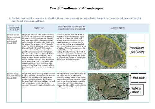
Students were required to investigate the economic, social and environmental impacts of human interactions with a key geographical landform in their local area and the impacts of the landform on human interactions. Over the course of two weeks, students visited the location, recorded their observations using maps and annotated images, and presented their findings by answering a series of structured questions.
As part of this inquiry, students conducted an investigation into the way in which the landform and its physical landscape shaped human interactions. They were also asked to compare the environmental, economic and social impacts of potential natural changes to the physical landscape.
Achievement standard
By the end of Year 8, students explain geographical processes that influence the characteristics of places and explain how places are perceived and valued differently. They explain interconnections within environments and between people and places and explain how they change places and environments. They compare alternative strategies to a geographical challenge, taking into account environmental, economic and social factors.
Students identify geographically significant questions from observations to frame an inquiry. They evaluate a range of primary and secondary sources to locate useful and reliable information and data. They select, record and represent data and the location and distribution of geographical phenomena in a range of appropriate digital and non-digital forms, including maps at different scales that conform to cartographic conventions. They analyse geographical maps, data and other information to propose explanations for spatial distributions, patterns, trends and relationships, and draw reasoned conclusions. Students present findings, arguments and ideas using relevant geographical terminology and digital technologies in a range of appropriate communication forms. They propose action in response to a geographical challenge, taking account of environmental, economic and social factors, and predict the outcomes of their proposal.
 1
Annotation 1
Presents findings in an appropriately formatted table 2 Annotation 2
Explains interconnections between people and places and within environments
-
Annotations
-
1
Annotation 1
Presents findings in an appropriately formatted table -
2
Annotation 2
Explains interconnections between people and places and within environments
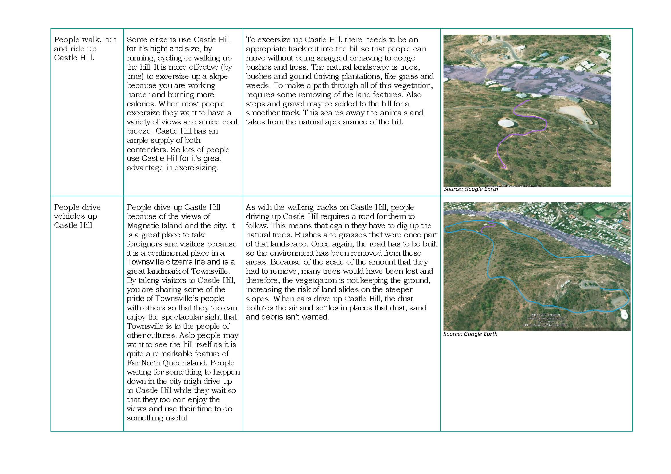 1
Annotation 1
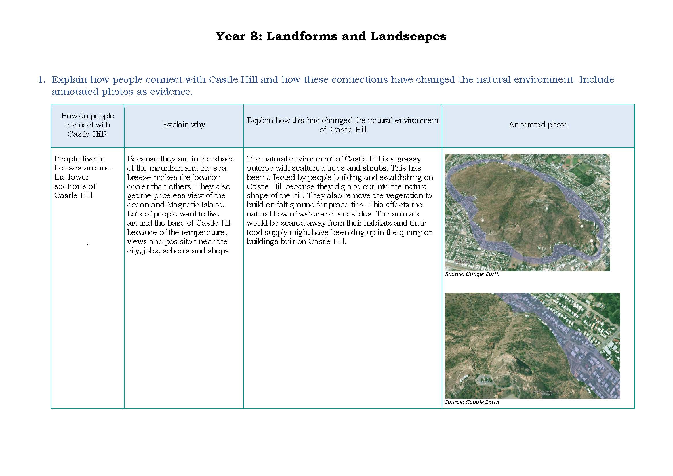
Explains interconnections between people, places and environments 2 Annotation 2
Supports findings with annotated photographic evidence
-
Annotations
-
1
Annotation 1
Explains interconnections between people, places and environments -
2
Annotation 2
Supports findings with annotated photographic evidence
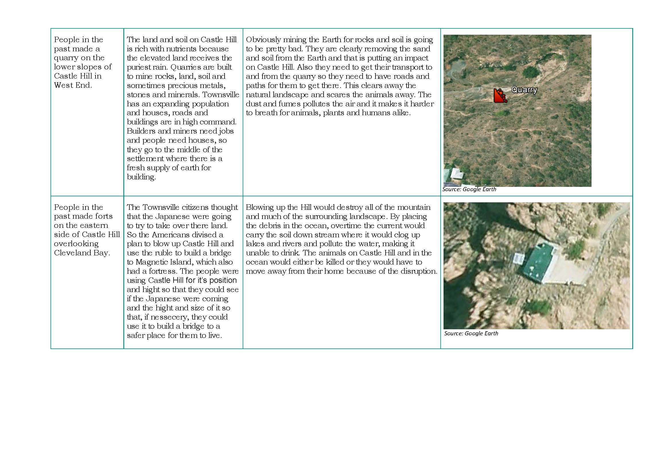 1
Annotation 1
Explains interconnections between people, places and environments 2 Annotation 2
Uses relevant geographical terminology
-
Annotations
-
1
Annotation 1
Explains interconnections between people, places and environments -
2
Annotation 2
Uses relevant geographical terminology
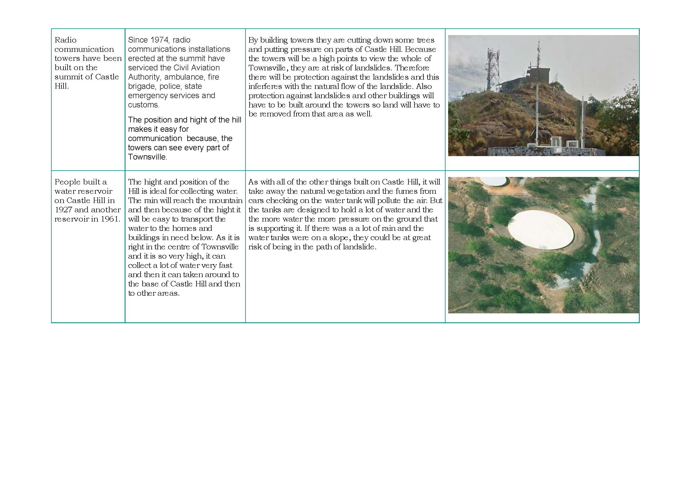 1
Annotation 1
Uses relevant geographical terminology 2 Annotation 2
Explains interconnections between people, places and environments
-
Annotations
-
1
Annotation 1
Uses relevant geographical terminology -
2
Annotation 2
Explains interconnections between people, places and environments
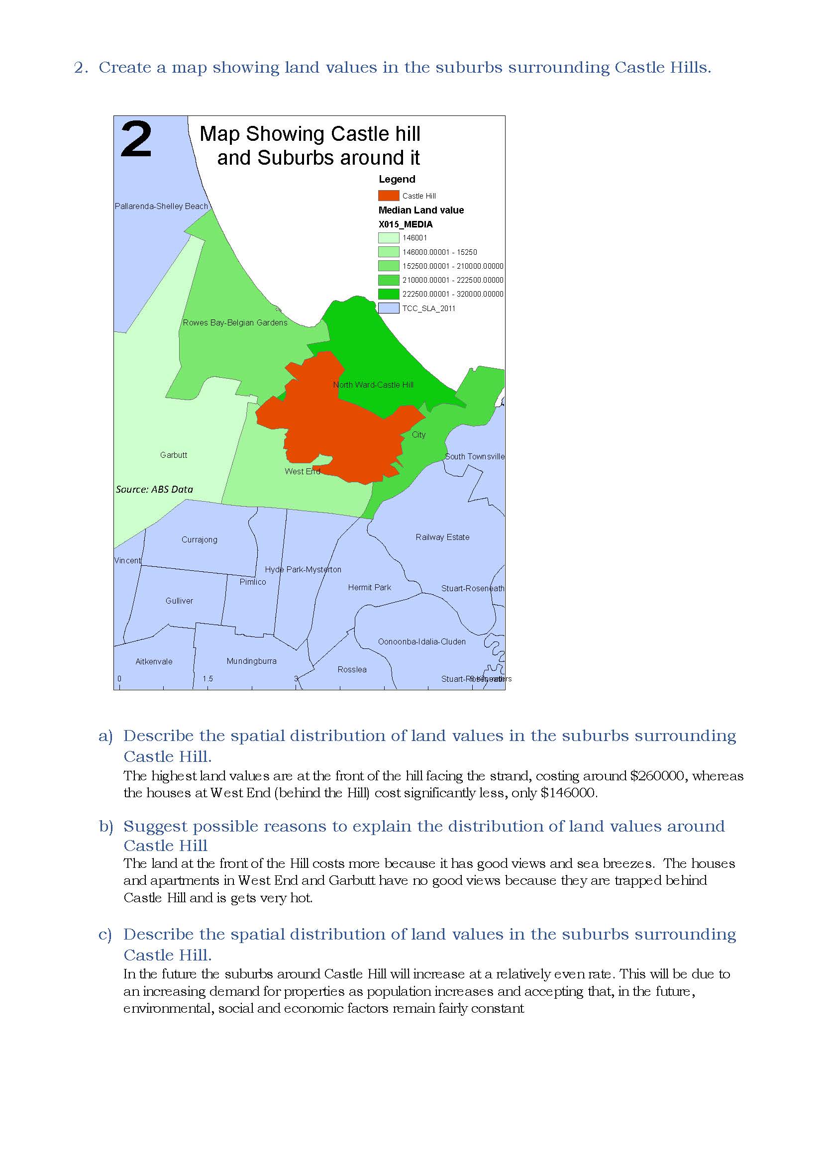 1
Annotation 1
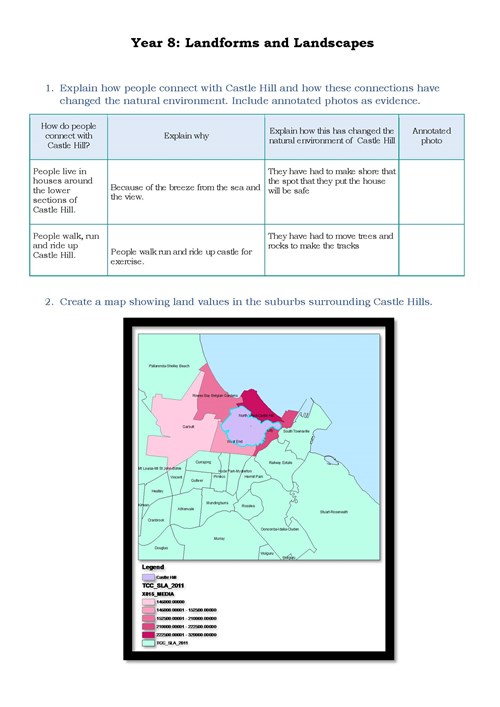
Uses a number of cartographic conventions 2 Annotation 2
Uses digital technologies to create a map showing land values 3 Annotation 3
Describes in simple terms the spatial distribution of land values based on the data in the map 4 Annotation 4
Provides an explanation for spatial distribution using geographical terminology 5 Annotation 5
Proposes changes to future land prices using geographical factors
-
Annotations
-
1
Annotation 1
Uses a number of cartographic conventions -
2
Annotation 2
Uses digital technologies to create a map showing land values -
3
Annotation 3
Describes in simple terms the spatial distribution of land values based on the data in the map -
4
Annotation 4
Provides an explanation for spatial distribution using geographical terminology -
5
Annotation 5
Proposes changes to future land prices using geographical factors
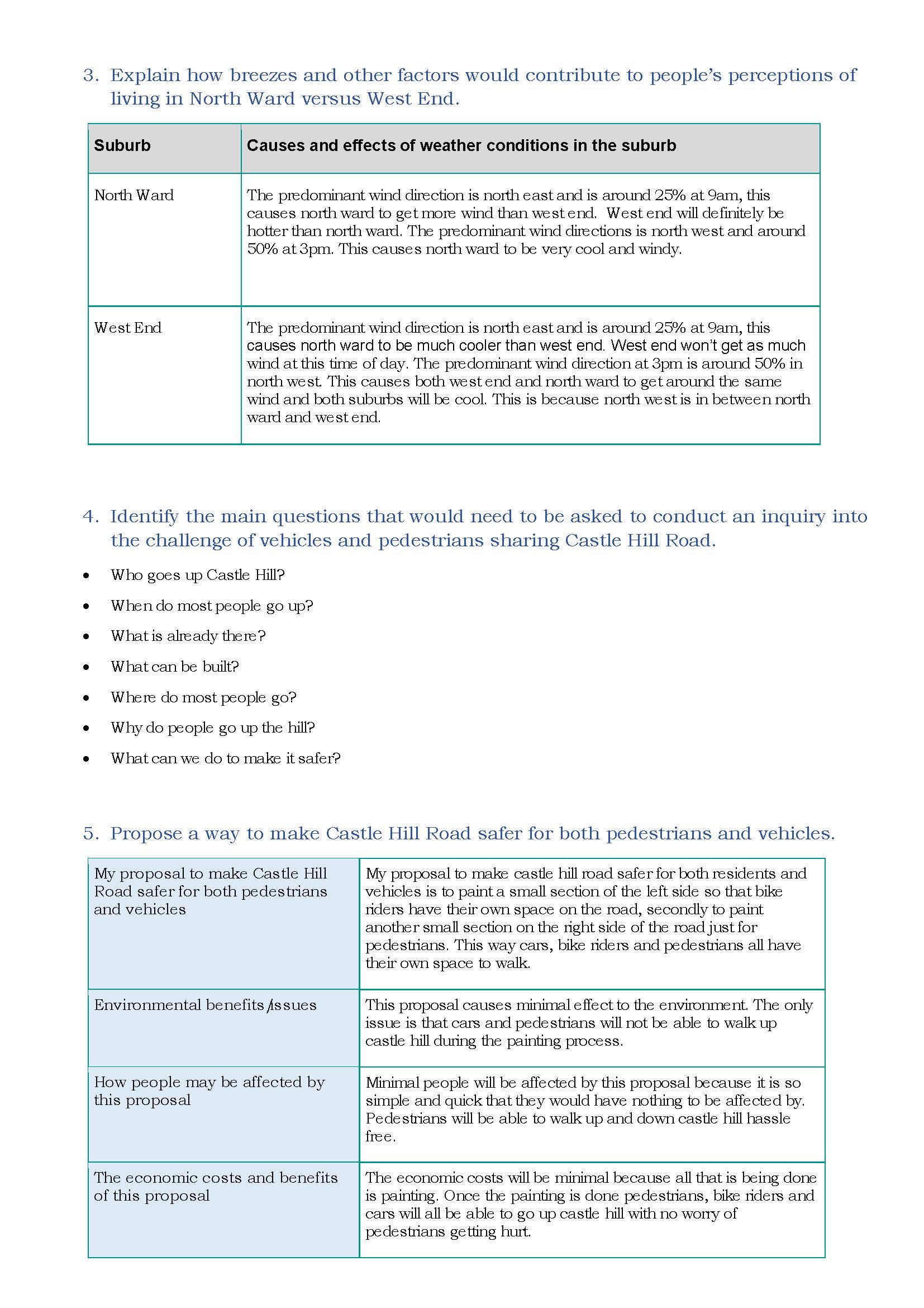 1
Annotation 1
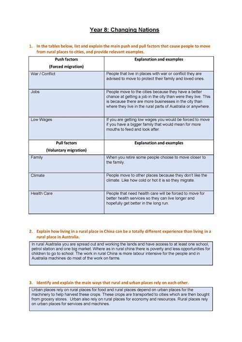
Provides an explanation of the effects of a geographical process on people’s perceptions of living in a place using data 2 Annotation 2
Proposes questions to frame a geographical inquiry 3 Annotation 3
Proposes a set of actions in response to a geographical challenge 4 Annotation 4
Presents predicted outcomes for each action
-
Annotations
-
1
Annotation 1
Provides an explanation of the effects of a geographical process on people’s perceptions of living in a place using data -
2
Annotation 2
Proposes questions to frame a geographical inquiry -
3
Annotation 3
Proposes a set of actions in response to a geographical challenge -
4
Annotation 4
Presents predicted outcomes for each action
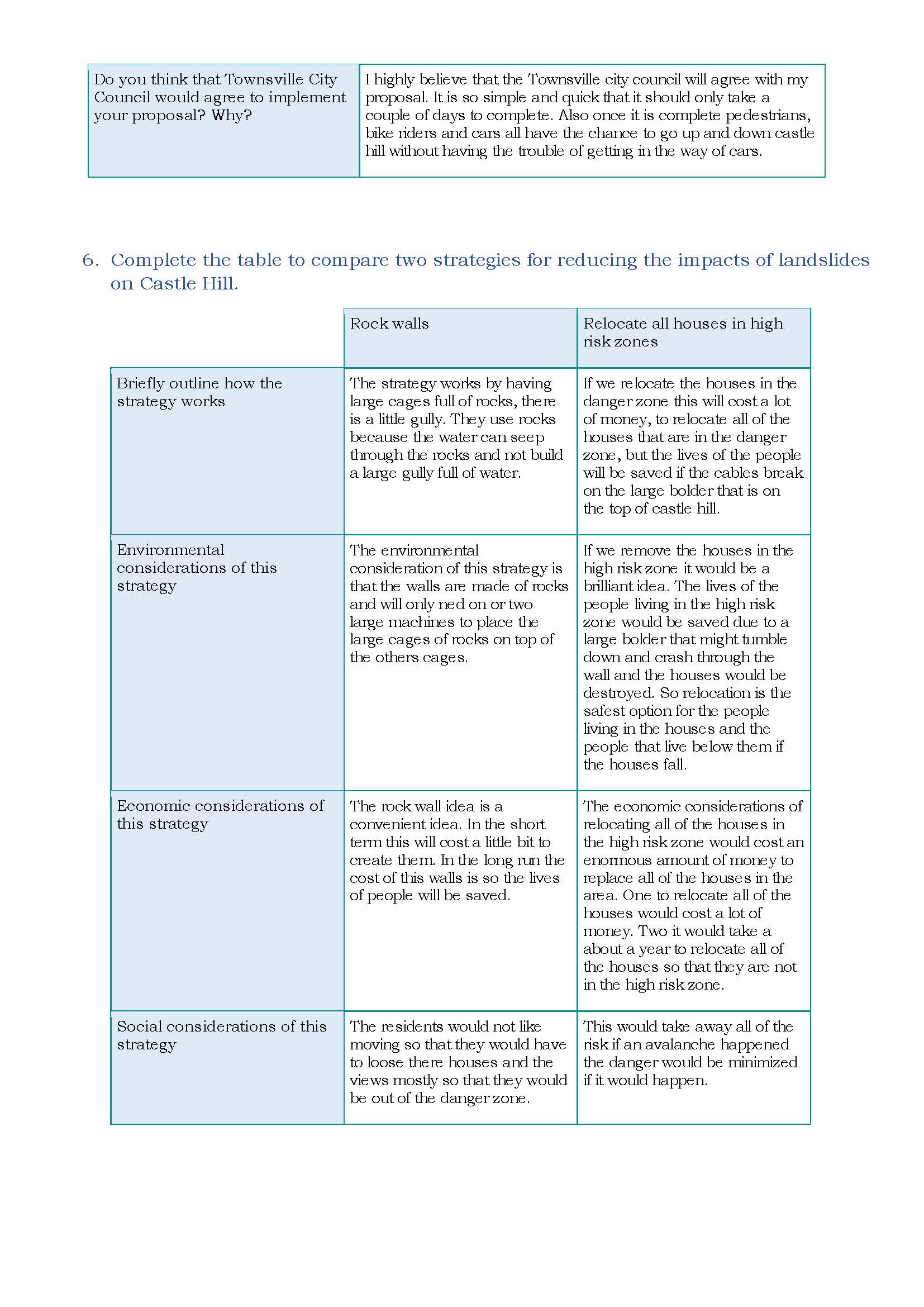 1
Annotation 1
Presents predicted outcomes for each action 2 Annotation 2
Presents information describing the environmental, economic and social impacts of the two strategies
-
Annotations
-
1
Annotation 1
Presents predicted outcomes for each action -
2
Annotation 2
Presents information describing the environmental, economic and social impacts of the two strategies
