Work samples

Geography

Year 10

Below satisfactory

Research assignment: Wellbeing indicators

Summary of task

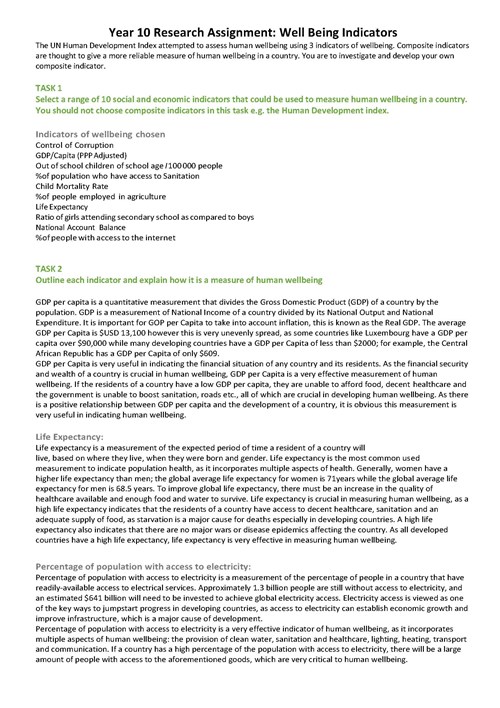
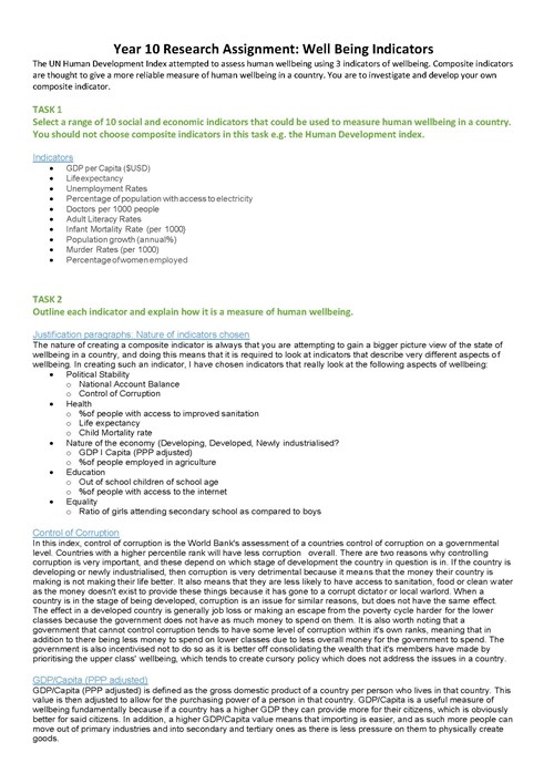
Over a period of four weeks before completing the task, students examined the concept of human wellbeing and factors affecting human wellbeing. Students discussed how effective quantitative and qualitative indicators are at assessing levels of wellbeing. They were then introduced to the idea that composite indicators (such as the UN Human Development Index) are thought to give a more reliable measure of human wellbeing in a country than other indexes. Given this background, students progressed through a staged inquiry over eight lessons to develop their own justified composite wellbeing index.

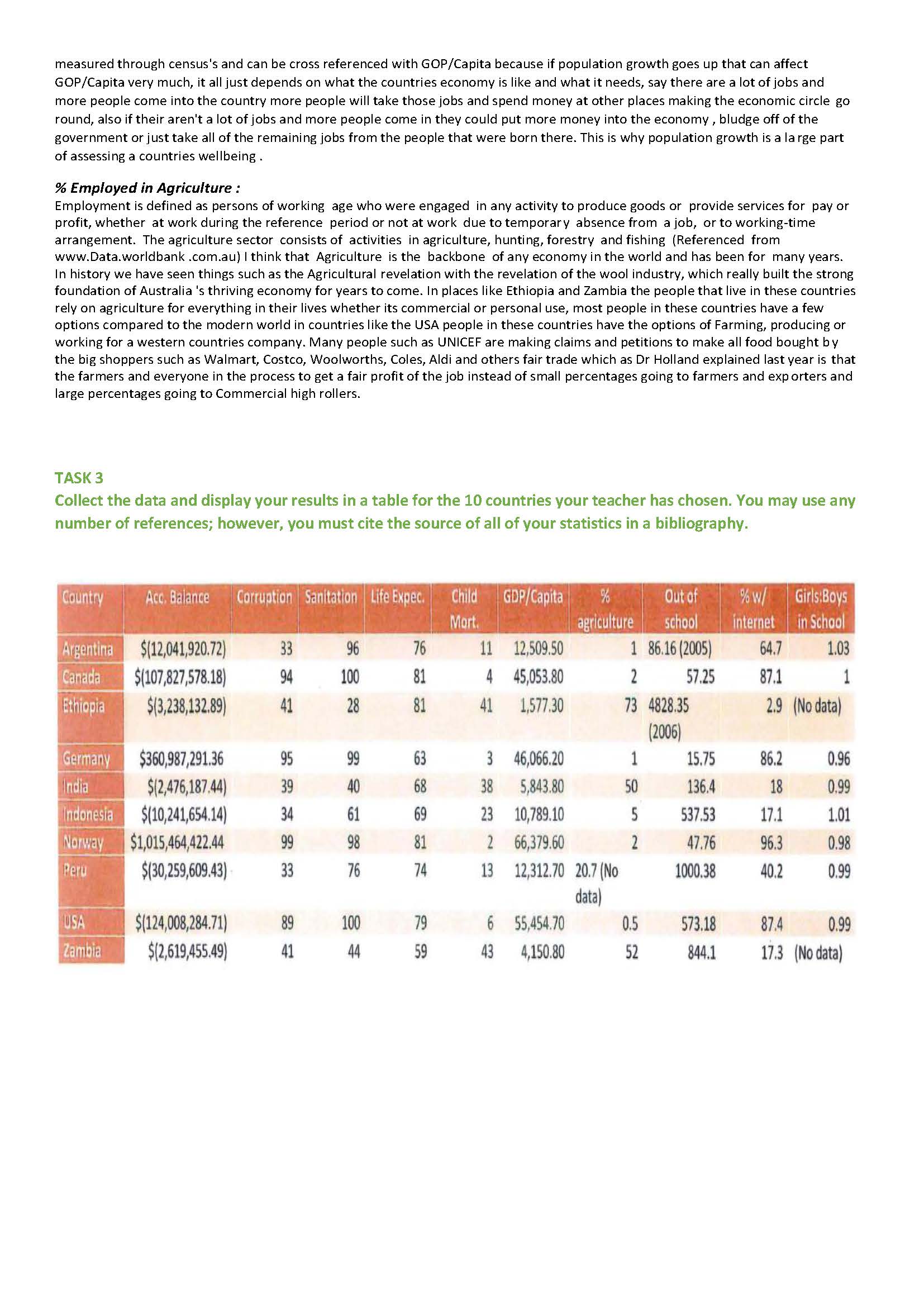
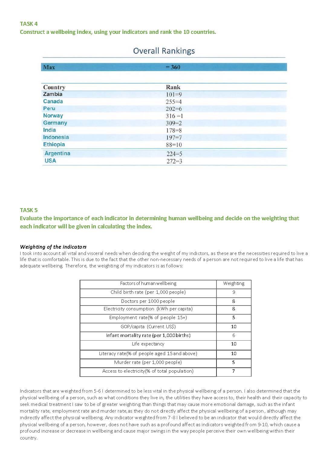
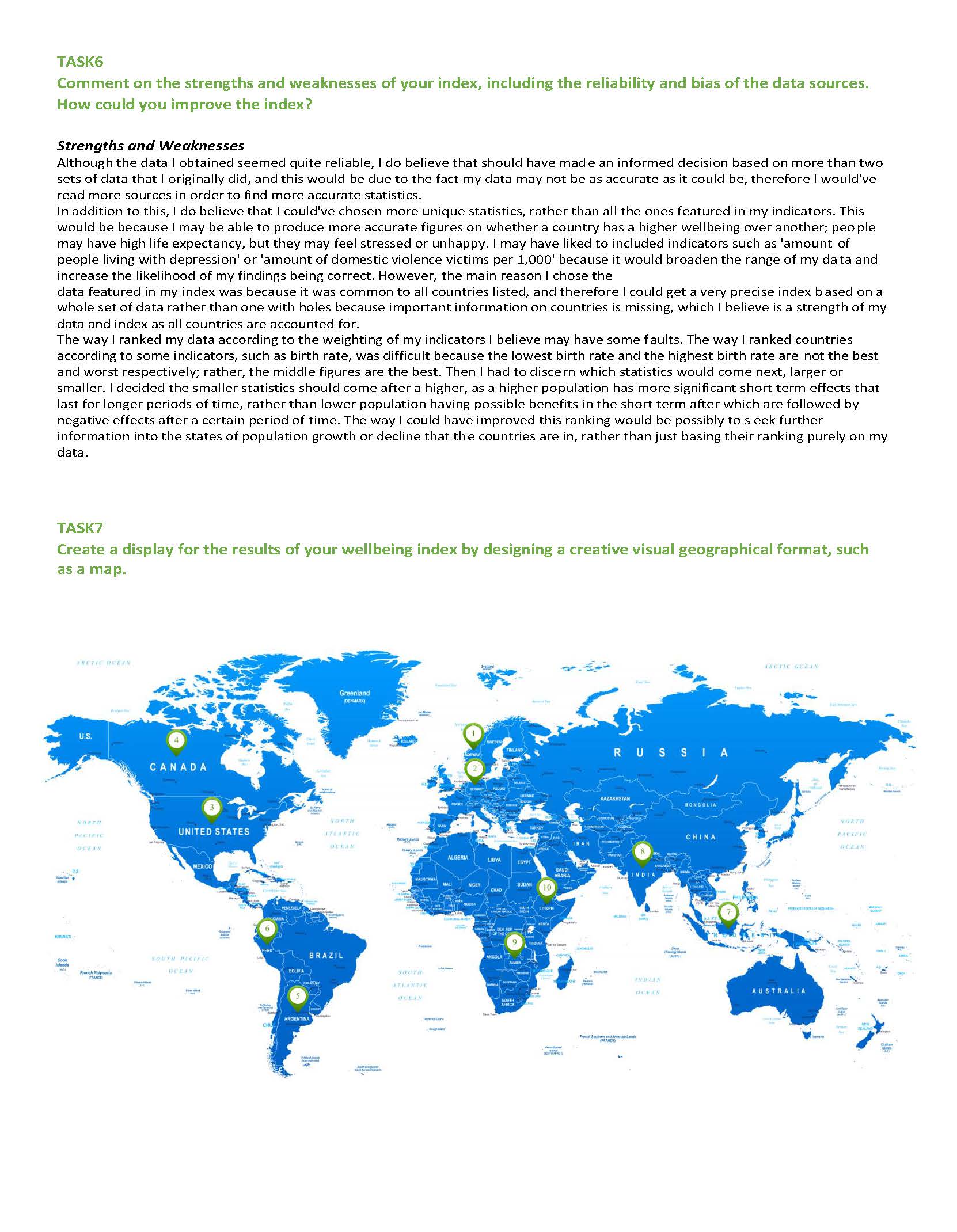
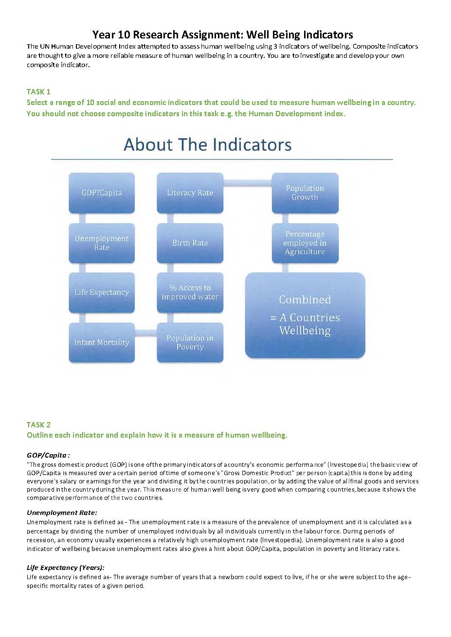
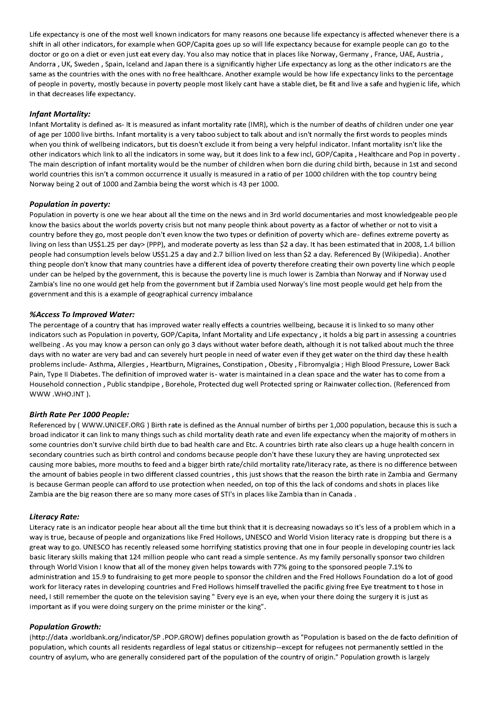
Specifically, students were asked to independently select and explain 10 social and economic indicators that they considered to be effective in measuring human wellbeing in a country and to collect the relevant data using internet research. Using the statistical data, students constructed a composite wellbeing index with teacher assistance in the development of their methodology where necessary. Students were required to evaluate (from their perspective) the importance of each indicator in determining human wellbeing and decide on the weighting that each indicator would be given to calculate the index. This index was then used to rank the 10 countries according to the value of the composite wellbeing index. Finally, students evaluated their index for strengths and weaknesses, including the reliability and bias of the data sources, and proposed how their index could be improved. They presented the results in a geographical format to creatively and imaginatively display their wellbeing index.
Achievement standard

By the end of Year 10, students explain how interactions between geographical processes at different scales change the characteristics of places. Students identify, analyse and explain significant interconnections between people, places and environments and explain changes that result from these interconnections and their consequences. They predict changes in the characteristics of places and environments over time, across space and at different scales and explain the predicted consequences of change. They evaluate alternative views on a geographical challenge and alternative strategies to address this challenge using environmental, economic, political and social criteria and draw a reasoned conclusion.

Students use initial research to develop and modify geographically significant questions to frame an inquiry. They critically evaluate a range of primary and secondary sources to select and collect relevant, reliable and unbiased geographical information and data. Students record and represent multi-variable data in the most appropriate digital and non-digital forms, including a range of graphs and maps that use suitable scales and comply with cartographic conventions. They use a range of methods and digital technologies to interpret and analyse maps, data and other information to make generalisations and inferences, propose explanations for significant patterns, trends, relationships and anomalies across time and space and at different scales, and predict outcomes. They analyse and synthesise data and other information to draw reasoned conclusions, taking into account alternative perspectives. Students present findings, arguments and explanations using relevant geographical terminology and graphic representations and digital technologies in a range of selected and appropriate communication forms. They evaluate their findings and propose action in response to a contemporary geographical challenge, taking account of environmental, economic, political and social considerations. They explain the predicted outcomes and consequences of their proposal.

Similar samples

Related samples